
Back in 1991, a very good friend of mine undertook the incredibly nerdy activity of recording on a map the tracks of all the tropical storms that year. His project lasted several years, and he had a nice collection of maps by the time he was done. Looking them over, I noticed something peculiar -- several of the storms passed through the Bermuda Triangle without coming in sight of land. A little bit of research showed me that a confluence of natural conditions may have contributed to the Triangle's nasty reputation.
Hurricanes are incredibly energetic storms. Rising air laden with moisture drives relentless circulation patterns, which are mostly vertical in the form of thunderstorms. Some estimates put the total energy in an average hurricane at around 600 terawatts per day, over two hundred times the electrical generating capacity of current human civilization. With air circulation comes accumulation of static electricity, resulting in lightning. Lightning is, of course, a plasma stream of highly ionized air molecules, releasing energy across a broad band of the electromagnetic spectrum, including light and radio waves. This can cause interference with radio communications, which has been commonly reported in Triangle cases. Also, before the launch of the first weather satellite in 1959, there was really no way to track tropical storms at sea except from shipboard observations. If no ships passed within visual range, hurricanes could -- and very often would -- pass by completely unnoticed. In the early days of maritime radio communications, a ship could pass into the storm's interference cloud so quickly that nobody would know what happened until the ship was late.

A quick check of NOAA records showed me that 91 storms are known to have passed through the heart of the Triangle since 1852. The tracks are shown in the image at right.
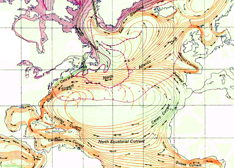
The Bermuda Triangle also encompasses the western extent of the Sargasso Sea. The currents of the North Atlantic Ocean circulate in a roughly oval pattern known as a gyre. Warm water flows up the East Coast in the Gulf Stream, across the North Atlantic to the coast of Purtugal, south along the Canary Current, and back across from Africa along the Equatorial Current to the Antilles Islands and the Caribbean. Right in the middle of all this, surrounding the 30th parallel, is a relatively calm area where thrives a species of seaweed known as sargassum, vast mats of which can accumulate on the surface. Christopher Columbus first reported these mats in his log, and to early sailing ships dense mats of sargassum could cause major troubles. If the wind is light, a sailing ship could become stranded in the sargassum for days or even weeks.
The confluence of these two factors no doubt fostered much superstition concerning the Bermuda Triangle. To date, no scientific evidence has been gathered to support the belief that the Triangle is anything other than a typical patch of sea -- to date, mind you. A lack of evidence does not mean that there is nothing unusual occurring there. But hypotheses concerning the location of the lost continent of Atlantis have little credibility in the deep waters and featureless ocean bottom of the Triangle, and space aliens will have to normalize diplomatic relations with the governments of the world before I will lend them any credence.
Of course, the Triangle will continue to inspire strange tales of the supernatural, and I welcome this.
No comments:
Post a Comment